Friday, March 27, 2009

City Tour With My Students

Today my students took me on a tour of 5 Incan ruin sites near Cusco. We walked most of it, even when it started to rain.

First top: Saqsaywaman, where the Inca king had his throne.

Walking up from Cusco to the ruins:


Me with my students in a doorway:


Landscapes of Saqsaywaman:


An engraving in the mountainside by soldiers - "Viva El Peru!":


My students overlooking the city:


Plaza de las Armas from afar:


Me with my students, Lucy and Jenny:


With the teacher I help, Angel:
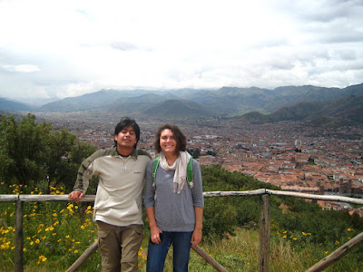

Angel demonstrating how Incas moved giant stones:


The Incas were amazing at carving and fitting together these multi-ton rocks. Good example in the pic below:


The ruins of Saqsaywaman were created in the shape of a lightening bolt:


At Qenko, stop number two. The bridge leading to the ruins, a labyrinth carved into rocks:


Inside the rocks:


The llama was the symbol of fertility to the Incas, so they carved it everywhere. Below is an example, with the neck, head and ear of a llama created in space by the carved rocks:


In the labyrinth:


On the way to our next stop, we saw these giant dolls in the trees. A little creepy:


These are "Incan" trees. They only grow above 3000m altitude:


At Tambo Machay, stop number three. The fountain of youth. No one knows where the water comes from, and it never slows down or speeds up. The Incan queen used to bathe here. Here, me an Lucy are getting a little of the magic water.


These are the three styles of architecture you'll see in the ruins around Cusco. At the bottom, the "cellular" style. In the middle, the "Incan" style, characterized by how they were able to cut stones with curves so they fit perfectly together, resembling pillows. At the top is the classical style.


Pretty landscape shot:


At Tambo Machay:


Taking a rest at Tambo Machay to eat some fruit.


Some sort of fruit resembling a pear...can't remember the name, but it's pretty ugly!


Okay, at the next stop, Puka Pukara, I didnt' get any pics at because it was raining really hard. The final stop was the Temple de la Luna. It's another cave inside a giant rock. At the top is a hole and at the Winter Solstace the light shines straight down onto a sacrificial table. Shot inside the temple:


Me inside the Temple, with my pancho still on...it was raining so hard!!


Monday, March 23, 2009

The Sacred Valley

This weekend I went on a tour of the Sacred Valley, the site of Inca ruins. There were three stops: Pisac, Ollantaytambo, and Chinchero, all places with the remains of Inca cities. They all kind of resembled a less impressive version of Machu Picchu, but the landscape and ruins are still beautiful.

Still in Cusco, waiting for the bus to leave - a little cluster of buildings surrounded by forest in the mountains surrounding the city:


In Pisac, getting choclo con queso - corn with cheese and a basil sauce resembling pesto on top. I thought the cheese would be melted on the corn but it was just a little piece stuck in the side of the husk. I admit it - i was a little disappointed.


On the way up to the ruins at Pisac. The mountains are so green, thanks to the Cusco region's yearly 6-month rainy season.


The Inca ruins at Pisac. They built all their temples, etc on the tops of mountains because they were great astronomers and it was easier to study the stars, sun and moon higher up.


Agricultural steps in the side of the mountain, where Incas planted things like quinoa, barley and other grains. They were so well built that they are still preserved today:


A system of fountains at the Pisac ruins:


At the top of the mountain:


The ancient city of Pisac:


Shot of the whole valley:


This shot is blurry but I liked it because it looked to me like an impressionist painting:


Ollantaytambo - houses in the side of the mountain. The pic below shows how big the mountain actually was


Huge! You can see the houses on the lower right.


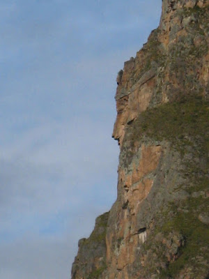
A face carved into the side of the mountain. If you look in the pic above, it's a little to the left of the houses.


Another face in the side of the mountain. If you look at the pic 2 above, it's on the left side of the mountain right next to a horizontal oval patch of blue. This is cool because they carved it so that on June 21 (their winter solstace), the sun rises from behind the mountain exactly where the nose is.


The Ollantaytambo market. All these markets pretty much sell the same stuff. You have to bargain for everything, which I hate but will do.


I got this silver ring with inlay mother of pearl representing the sun. It's better in person but my camera is not good at jewelry shots.


Shot of the Ollantaytambo valley:


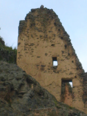
The remains of a structure they used to keep crops. The Incas were agricultural scientists - for example, they cultivated 800 varieties of corn, but today we only know of about 200.


Our last stop: Chinchero. It was dark and we were all beat, but the town square turned out to be quite pretty at night. The cathedral, obviously from post-Spanish arrival:


The cathedral, with the market below: